London Underground Map
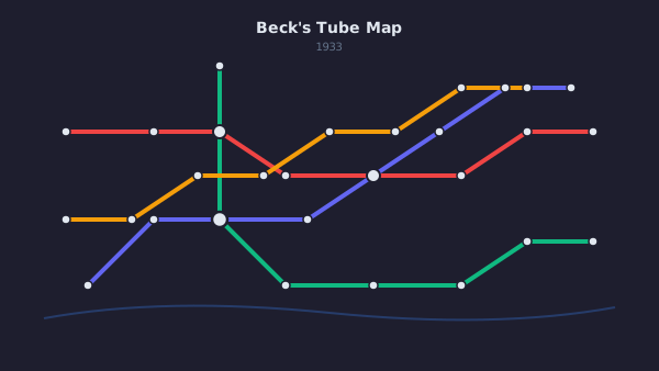
Historic해리 벡(Harry Beck)의 1933년 런던 지하철 노선도는 20세기 가장 영향력 있는 정보 디자인이라고 해도 과언이 아닙니다. 지리적 정확성을 포기하고 위상학적 명료함을 택함으로써 — 선을 45도와 90도 각도로 곧게 펴고 역 간 간격을 균등화하여 — 벡은 승객이 실제로 사용할 수 있는 개략도를 만들어냈습니다.
Harry Beck's 1933 London Underground map is arguably the most influential information design of the 20th century. By abandoning geographic accuracy in favor of topological clarity — straightening lines to 45° and 90° angles, equalizing station spacing — Beck created a schematic that passengers could actually use.
이 디자인의 통찰은 지하철 이용객에게 지리적 거리가 아니라 노선 간 연결, 환승 지점, 순서가 중요하다는 것이었습니다. 사용자가 실제로 필요로 하는 과제에 맞춰 표현을 단순화함으로써, 벡은 복잡한 네트워크를 탐색 가능하게 만들었습니다.
The design insight was that underground travelers don't need to know geographic distances; they need to know connections, transfer points, and sequence. By simplifying the representation to match the user's actual task, Beck made a complex network navigable.
오늘날 전 세계 모든 지하철 노선도가 벡의 원칙을 따르고 있습니다. 더 넓게 보면, 그의 지도는 정보 디자인이 물리적 현실을 그대로 반영하기보다 사용자의 멘탈 모델에 봉사해야 한다는 개념을 확립했습니다. 이 원칙은 오늘날의 모든 대시보드, 네트워크 다이어그램, 시스템 아키텍처 시각화에 여전히 메아리치고 있습니다.
Every metro map in the world now follows Beck's principles. More broadly, his map established the concept that information design should serve the user's mental model, not mirror physical reality. This principle echoes through every modern dashboard, network diagram, and system architecture visualization.